Pallabi Bhattacharya

Aurora, IL,60504 US.
bhattacharyapallabi21@Gmail.com

Hi! My name is Pallabi Bhattacharya, and I am a dedicated GIS and Remote Sensing Analyst with knowledge in several widely used geospatial software and pogramming. I'm a fast learner and can work both independently and with teams. My goal is to seamlessly integrate GIS with advanced technologies like machine learning, deep learning and programming. Motivated by a passion for Earth sciences and cutting-edge innovations, I strive to remain at the forefront of technological advancements through continuous learning and practical application of my skills.
Projects

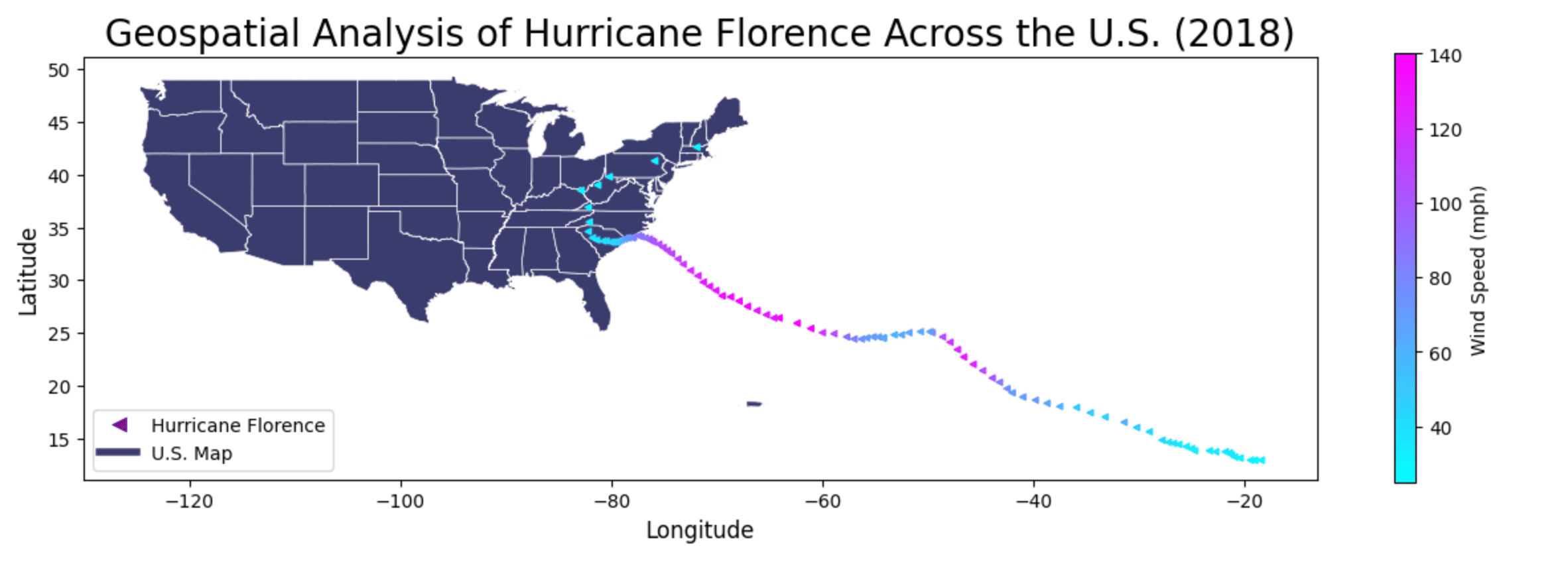
Geospatial Analysis of Hurricane Florence Across the U.S. (2018)

Geospatial Analysis of Hurricane Florence Across the U.S. (2018)

This map illustrates the trajectory and intensity of Hurricane Florence, a powerful Cape Verde hurricane that struck the Carolinas in September 2018, causing catastrophic flooding and destruction. The storm's path is visualized using directional markers ("<"), color-coded based on wind speed variations, helping to analyze when and where the hurricane intensified. The U.S. map is displayed in blue, while a color scale (legend) on the right represents the range of wind speeds, providing insight into the storm's strength at different locations. Latitude and longitude grids enhance spatial context, allowing for a clearer understanding of the hurricane's movement. By analyzing this map, we can track where Hurricane Florence originated, how it evolved over time, and the regions most affected by its impact. This geospatial visualization serves as a crucial tool for disaster analysis, meteorological research, and emergency preparedness in understanding the devastating effects of hurricanes.

Completed

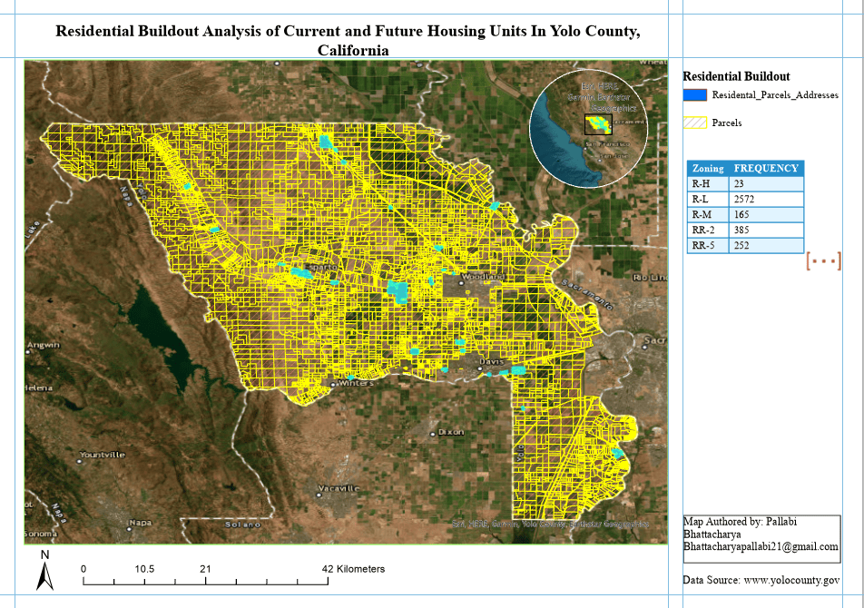
Residential Buildout Analysis of Current and Future Housing Units In Yolo County, California

Residential Buildout Analysis of Current and Future Housing Units In Yolo County, California
Completed

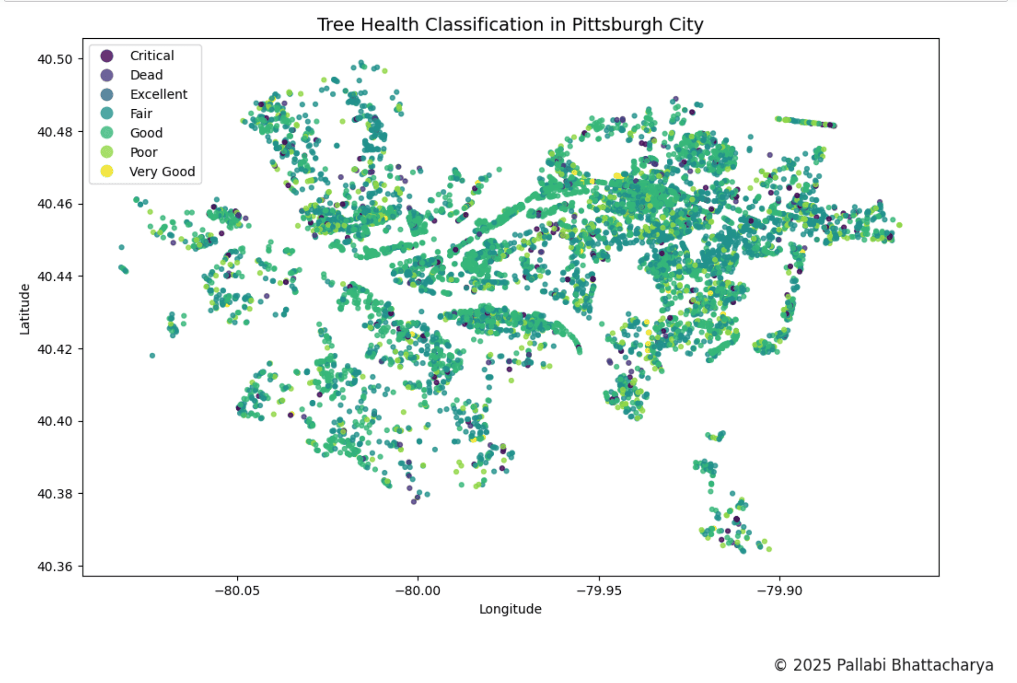
Tree Health Classification in Pittsburgh, Pennsylvania

Tree Health Classification in Pittsburgh, Pennsylvania
Completed

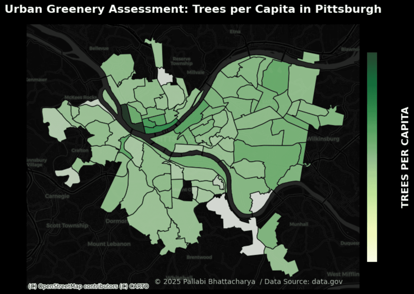
Urban Greenery Assessment Trees per Capita in Pittsburgh, Pennsylvania

Urban Greenery Assessment Trees per Capita in Pittsburgh, Pennsylvania

This map illustrates the trajectory and intensity of Hurricane Florence, a powerful Cape Verde hurricane that struck the Carolinas in September 2018, causing catastrophic flooding and destruction. The storm's path is visualized using directional markers ("<"), color-coded based on wind speed variations, helping to analyze when and where the hurricane intensified. The U.S. map is displayed in blue, while a color scale (legend) on the right represents the range of wind speeds, providing insight into the storm's strength at different locations. Latitude and longitude grids enhance spatial context, allowing for a clearer understanding of the hurricane's movement. By analyzing this map, we can track where Hurricane Florence originated, how it evolved over time, and the regions most affected by its impact. This geospatial visualization serves as a crucial tool for disaster analysis, meteorological research, and emergency preparedness in understanding the devastating effects of hurricanes.

Completed

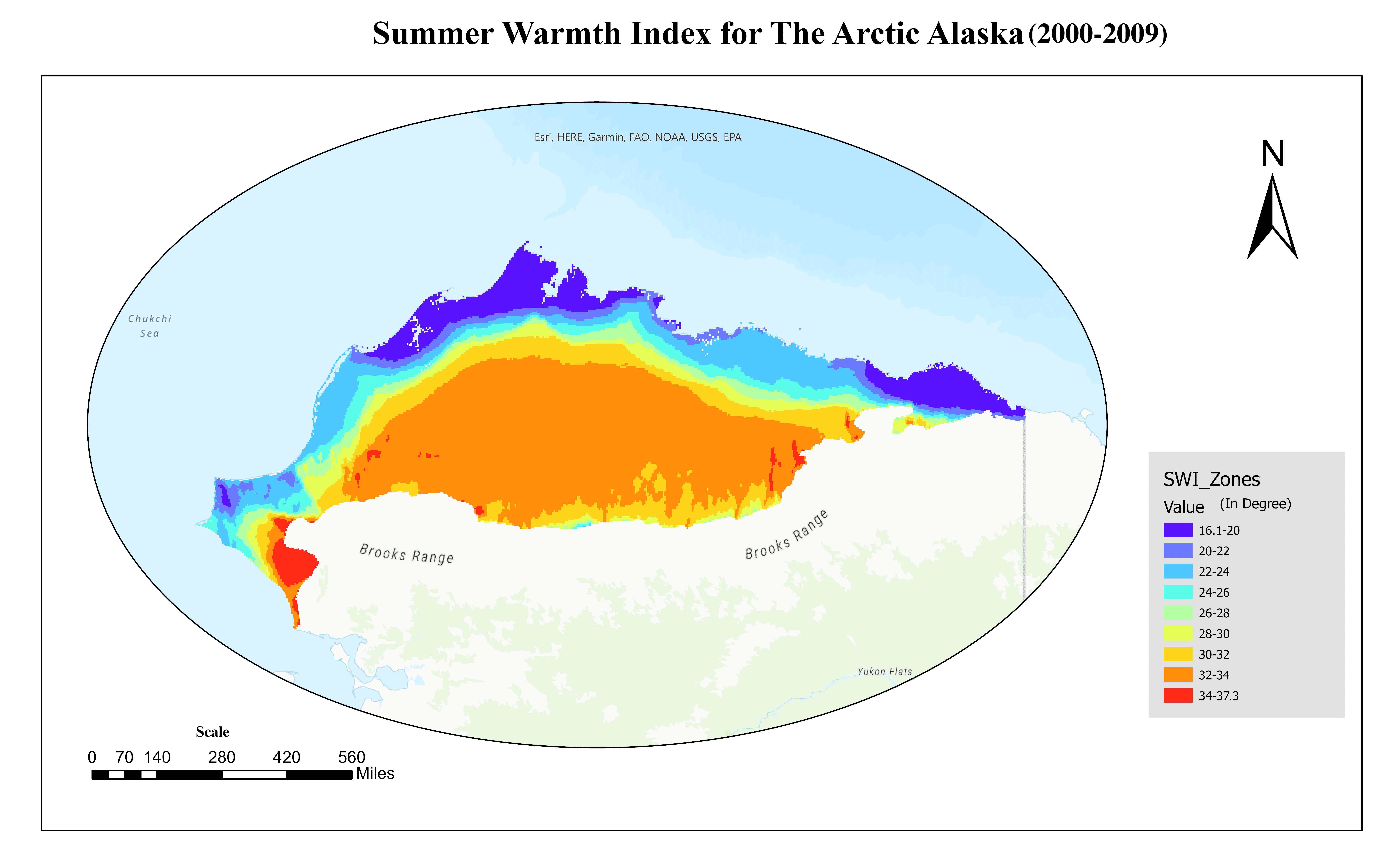
Summer Warmth Index for The Arctic Alaska (2000 - 2009)

project05_img1
Completed

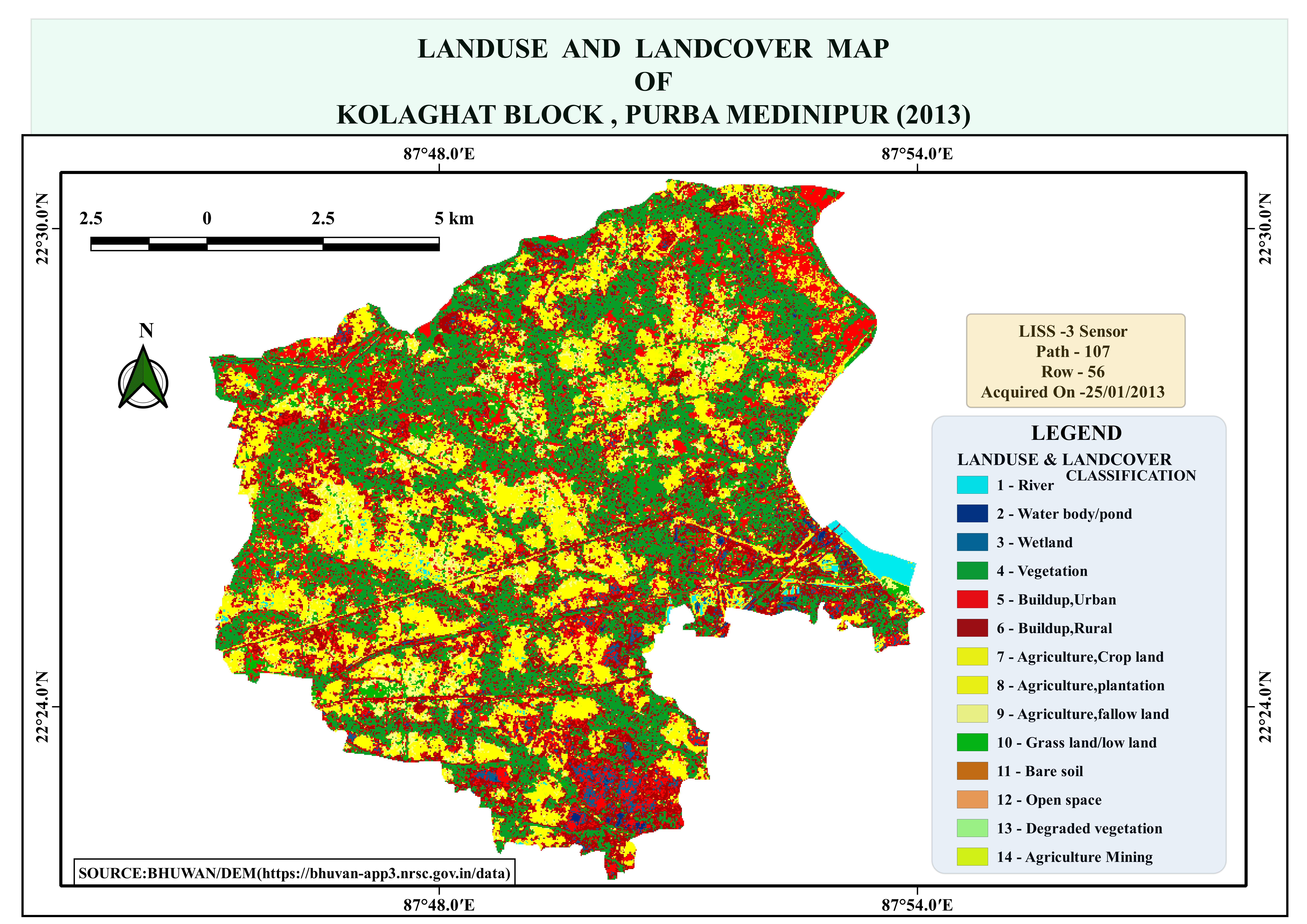
Landuse and Landcover Classification of Purba Medinipur, India (2013)

project05_img1
Completed

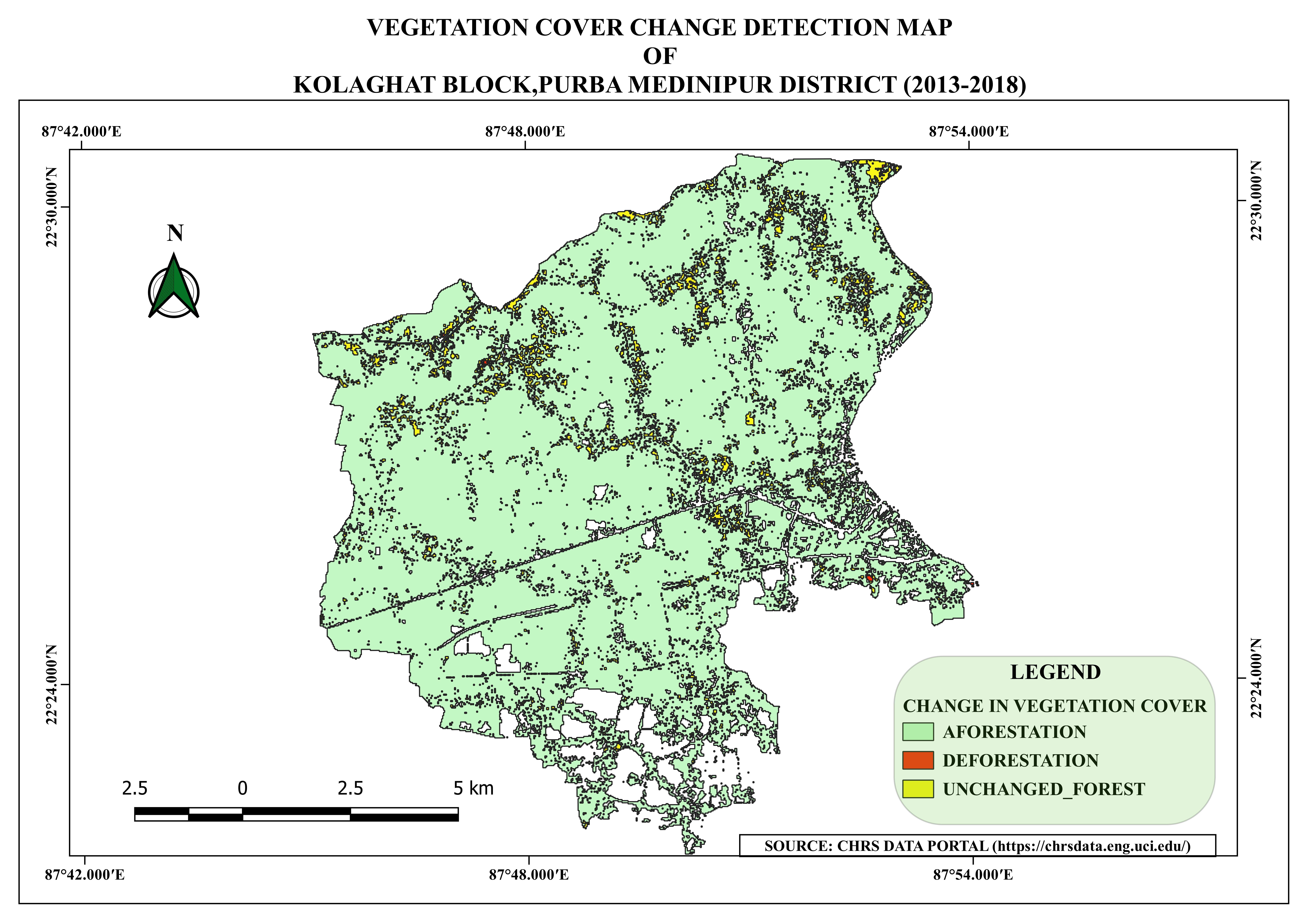
Vegetation Cover Change Detection of Purba Medinipur, India (2013)

Vegetation Cover Change Detection of Purba Medinipur, India (2013)
Completed

Education

University Of Calcutta

Masters in Geography
July 2019 - July 2021

University Of Calcutta

Bachelor's in Geography
July 2016 - June 2019

Bagnan Girls High School (WBBSE)

Class 5th to Class 12th
July 2009 - June 2016

Skills

Technical Skills
  • ESRI, ArcGIS Suite, ArcGIS Pro, Arc GIS Online, QGIS, Google Earth Pro, PostGIS, WebGIS
  • Python, ArcPy, R Programming, LaTex
  • HTML, CSS, Javascript
  • SQL, MySql, PostGre SQL
  • GitHub, Git
  • AutoCAD
  • Microsoft Office (Excel, Word, Powerpoint), PowerBI
Research Interests
  • Remote Sensing
  • Land Use and Land Cover Change
  • Climate Change
  • Terrestrial Environments
  • Geospatial Analysis
Certifications
  • Google Project Management: Professional Certificate (May 2024) (July 2024) Esri web course: Going Places with Spatial Analysis. (March 2024)
  • Esri web course: Transform AEC Projects with GIS and BIM. (May 2023)
  • Esri web Course: Data Management. (April 2023)
  • Esri web Course: Python for Everyone. (March 2023)
  • Esri web Course: Classifying Objects Using Deep Learning in ArcGIS Pro. (March 2023)
  • Sololearn:Python Intermediate and Introduction to SQL, 2023.
  • Udemy: ArcGIS Desktop For Spatial Analysis: Go From Basic to Pro (Jan 2023)

Interests

My first passion is computers and I love to code for fun. I love working on small fun side projects (software and hardware related) as a hobby. I love listening to music and podcasts, playing computer/indoor games, modeling, or making new creations using blender, following news relating to technology and current affairs. Above all else, when I get free time and a reason to go outside, I love to hang out with friends, take photographs, and explore nature.